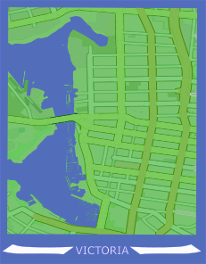
Minimalist Map - Victoria, BC
You can download all project files here.
Outline
- Utilized Open Street Map to format .svg files in the form of city streets.
- All map object editing was done in Inkscape, a free and open source svg illustration software.
Outcomes
Tapping into a more artistic side, I wanted to try out minimilistic style artwork using maps. I really enjoy well designed city streets and think that the capital city of my home province does a great job of maintaining walkability, and still having efficient roadways that intertwine within the downtown core of the city.
I wanted the coastline to be a major portion of the map, as the city sits at the very southern tip of Vancouver Island. Coastal water is a very significant part of British Columbia and I wanted to combine cityscape with the natural element.
